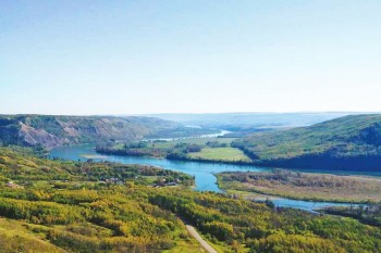
Charlie Lake
In May of 1942, as part of the construction of the now world-famous Alaska Highway, a US Corp of Engineers Pontoon Barge carrying seventeen soldiers and equipment across Charlie Lake sank, taking the lives of twelve soldiers. In 2008, a monument was erected in memory of the soldiers that lost their lives that day. You can learn more about their stories and visit the monument at the Rotary Boat Launch at Mile 52 of the Alaska Highway.
Kiskatinaw
A short detour off the main highway onto an old section of the Alaska Highway will lead you to the last remaining curved wooden bridge on the highway. It is very picturesque and a great place to picnic can be found down below in the Provincial Park.
Fort St. John
Few places on earth can match the raw beauty and spectacular environmental bio-diversity of the Muskwa-Kechika Management Area (M-KMA). The M-KMA encompasses 6.4 million hectares (15 million acres), an area roughly the size of Ireland. Unlike a park, the M-KMA comprises a number of land use areas including parks designated for varying levels of protection, conservation and use. This magnificent area is located in northeastern British Columbia and is bordered by the communities of Fort Nelson, Fort St. John and Mackenzie. Areas of interest for motorists include Stone Mountain, Muncho Lake and Liard River Hot Springs Provincial Parks.
Hudsons Hope
A free self-guided tour will take you back to the pioneer days of the area, the construction of the dam, and to the discovery of dinosaur tracks in the canyon. Open Daily; May long weekend to September long weekend.
Hours: 8:00am – 4:00pm
Fort St. John
Learn more about Fort St. John's roots by visiting the Peace River Lookout Point located at the south end of 100th Street. This lookout provides wonderful views of the Peace River. There are two interpretive signs placed there by the Fort St. John North Peace Museum and Peace River Regional District. The first sign explores the history of the Peace River as the highway of the north from canoes and scows to steamboats and sternwheelers. Learn about the D.A. Thomas - the largest, most luxurious, and best-known steamer on the Peace. The second sign examines five historic landmarks that could once be seen from this lookout. These sites include the British Columbia Police Barracks and Jail, the Pacific Great Eastern Railway Bridge, the North West Mounted Police Trail, Fort St. John (1858-1872), and Old Fort St. John (1873-1923). Pack your camera and a lunch or snack and enjoy the beauty and history of the Peace River.
The Site C viewpoint is now open on the north bank of the Peace River above the dam site. This viewpoint gives visitors an opportunity to watch Site C construction activities from a safe distance. The viewpoint is located immediately west of the City of Fort St. John, on the south side of Highway 97. Visitors can access the viewpoint by driving south on 269 Road, past the Peace River Regional District landfill. Approximately 500 metres south of the landfill, turn right to access the viewpoint. The turnoff will be marked with a large sign.
Hudsons Hope
Your experience begins with interactive displays in the Visitor Centre; you then get to enjoy a movie on the building of the dam. Then don a hard hat, jump on the bus, and head down the hill for your underground tour of one of the largest powerhouses in the world.
Open Daily; May long weekend to September long weekend. Hours: 10:00am – 6:00pm


